Total Pageviews

Showing posts with label Phantom Ranch. Show all posts

Saturday, 5 August 2023

Travel Biography - Week 60.

The Unusual Layout of this Week's Blog.

This week's blog is about the second part of my 1995 hike into the Grand Canyon, where my task of taking photos of the Inner Gorge is complete. Therefore, instead of interspersing several pics within the text, as I usually do, on this occasion only, I will place all the photos and their captions in an uninterrupted row beneath the text.

As I have written about these hikes in the past or are familiar with my Facebook page, some of you may already be familiar with these photos. For others, they may be seen for the first time. For everyone,  I hope that after reading the text, you will also enjoy browsing through the pics. Also, note that all the photos displayed here are my own, to fulfil the main purpose of the hike. There are no stock photos posted here.

The distances are given in miles. To convert to kilometres, multiply the number by 1.62. For example:
3 miles - 3 x 1.62 = 4.86 kilometres.

The Morning After.

After a successful descent into the Grand Canyon on the Bright Angel Trail, I settled under the stars. This was due to the hike being "illegal" in the sense that I wasn't carrying a Camper Pass, a document I should have gotten if I was lucky in the lottery draw at the Visitor's Center in the Village. The lottery draw decides who will go down to spend the night deep within the Canyon from those who won't. The draw was still yet to take place at seven o'clock that same morning. In other words, had I conformed to the Park rules, I would still be at the South Rim village, most likely having slept under the stars, or found an ultra-expensive room at one of the Rim hotels, which according to my budget, would have been very unlikely. As it was, I took a chance and completed the descent to a spot near where Bright Angel Creek flows to join the Colorado River.

I woke up from my meagre sleep around five, just as the dawn was breaking. The sky was clear, and the Milky Way became obscured by the velvety blue of the cloudless sky. Soon afterwards, human life began to stir as both the Ranch and the campground began to empty of hikers starting their trek towards South Rim, mainly on the Bright Angel Trail. Also, I watched the campers at the official campground pack away their tents into their rucksacks and also began their hike back to the Rim.

I rose from the picnic table on which I lay, and taking my heavy rucksack, made my way to Phantom Ranch, a little further along the trail in the direction of North Rim. The whole night was far from pitch dark and silent. The millions of stars making up the Milky Way, along with the full moon, kept the Canyon floor well-illuminated with natural light. Added to that was the constant sound of the Bright Angel Creek waters flowing as if in a headlong rush to meet the mightier Colorado River.

I got chatting with one of the staff members who was in charge of the Ranch dining room, a slim, bearded man who supervised a fairly large room in which parallel rows of tables were arranged with their seating. All the places were vacant. As I bought some breakfast and made my way to a chair, I was stopped by the bearded supervisor without any explanation for his move. However, he wasn't hostile, and with just the two of us in the restaurant, we kept on chatting about how the Ranch was managed whilst I was eating standing up. Somehow, I was able to sense that he enjoyed talking to me. I have wondered how many visitors saw him as a human being loyal to his duties rather than always on the beck-and-call of impatient customers.

Most, if not all, hikers had left both the Ranch and Campsite. That I wasn't permitted to sit for breakfast indicated that there were more customers to have made an appearance, to whom the seating was reserved. But they weren't individual hikers. Rather, they were more likely a party of mule riders. There was also a possibility that there was a party of river rafters. Their inflatable boats, designed to ride more smoothly over the rapids, were known as dories. Both were actually escorted groups, therefore, I didn't find it too surprising that they took priority in the restaurant.

The Ascent Hike Begins.

One big difference I felt after arising that morning, and that I was no longer concerned about meeting a Park Ranger. Thus, there was no longer the humiliation felt if ordered back to the Rim, or even worse, faced a fine set by the Park authorities of several hundred dollars. However, I wanted to linger around the Canyon floor for a while rather than set off so early, like I did in 1978 when I left around 5.00 AM. However, I also wanted to have a taste of the North Kaibab Trail that linked Phantom Ranch to the North Rim and the Lodge near the trailhead. But, as I found out from the Ranch supervisor, a landslide had closed the trail for several months in 1995. This meant that even if I wanted to, I wouldn't have been able to hike to the North Rim, although that idea appealed to me.

Instead, I hiked a little way up along North Kaibab Trail. How far, I never recorded. But it must have been a few hundred metres. If the diversion was up to 400 metres, then I could say that the 9.6 miles from Rim to Ranch would have rounded up to ten miles. Realising the trail blockage, I then turned back to the Ranch and passed through. Where the creek, or stream, joins the river, I lingered, admiring Zoroaster Temple towering over me and looking so near. 

I then made my way to Siver Bridge and crossed the River to reach the South side of the Inner Gorge. Looking towards the west from the bridge, a section of the South Tonto at Plateau Point was just visible as it juts into the Inner Gorge, backed by a section of cliff resembling a pyramid. To the east, Zoroaster Temple, the now most familiar butte, dominates the skyline.

The trail ran along the bank of the River for up to two miles before reaching a turning at the mouth of Bright Angel Trail proper. Opposite the trail turning was a small incline to a small sandy beach. How lucky I felt when a passing hiker took a picture of me sitting on a boulder with one foot in the freezing water! That photo became the hiking classic.

I carried along the trail, leaving the River for good, fording Pipe Creek, and passing the seven-mile rest station. I then proceeded to the start of the Devil's Corkscrew.

Still cool as the morning wore on, I didn't find the wide switchbacks too overbearing as I carried the heavy rucksack on my back. Throughout, I kept sipping at the gallon water bottle I filled at Phantom Ranch. I was doing well. The Corkscrew offered fantastic views of itself as the sun shone into the recess of the Inner Gorge through which the trail runs. Both in 1978 and the previous day's descending hike, the switchbacks were under shade. The sunshine brings out its glory.

At last, I arrive at Havasupai Gardens, formerly the Indian Gardens of Tonto Plateau. With such a nice atmosphere created by visitors and passing hikers, I thought about resting here for a while and soaking in the experience. I sat, drinking water and facing the North Rim. Just ahead of me, the trail divided. The main trail, from where I had just come, dropped into the Inner Gorge, from it a 1.5-mile trail branch terminated at Plateau Point, on the rim of the Inner Gorge.

I decided there and then to check out Plateau Point, adding a total of three miles to the hike. But it was worth every step of the way! Yet, what I found astonishing was that despite the crowds, I was totally alone. I walked across the level desert scrubland to the Point. The view offered was absolutely breathtaking!

I was looking down the near-vertical walls of the Gorge. Directly below was the river, a ribbon of brown, murky water twisting its way through the Canyon. Directly ahead, Cheops Pyramid Butte stood as a giant formation towering over me, whilst Brahman's Temple and Zoroaster Temple formed the two pinnacles defining the eastern horizon. Behind me, to the south, the cliff wall of the South Rim loomed above, and warning me that the hike was far from finished.

Eventually, as evening was already drawing near, I headed back to Havasupai Gardens, passed through and carried on to the start of Jacob's Ladder, the first section of a long series of switchbacks that would eventually lead me back to the village. It was at the three-mile rest hut that I refilled my water bottle.

I took on one switchback after another as I struggled uphill with a heavy rucksack on my back. It was getting dark, and I realised that I spent too much time at Havasupai Gardens and Plateau Point. Yet, I had no regrets. I actually believed that I bargained more than most hikers. After all, I was all alone at Plateau Point and had all the wonderful views to myself. But the cost? Three extra miles added to the hike, making the whole round trip some 23 miles long.

Then it Happened.

The trail was deserted as I struggled along, sipping water. Suddenly, somewhere on the cliff, a sudden very sharp cramp pain hit my left thigh, right down to my lower leg. I felt my muscle tighten as if squeezed by a huge, invisible hand. I couldn't move. 

I struggled further despite the pain. It was dark by this time and the trail was deserted, lifeless, as if long abandoned. A big contrast to a typical summer's day when the trail is crowded with hikers and casual walkers. Eventually, I couldn't keep going any longer, the cramp pain was so severe. Compounded by the heavy rucksack, I laid down on the trail, my damp shirt getting covered with sand. I was no longer able to move. I thought that was it. My time had come. I began to recite Scripture, mainly from the Gospel of John. I thought that this was a good place to die as anywhere else. I closed my eyes and waited for the moment.

I felt defeated, blasted hope further dashed. Not by the hike but by life in general. Still single at 43 years of age, the very thought of marrying and raising a family was as remote as a tiny oasis in the huge Sahara Desert. I know what it's like being ridiculed by two young women in the church, treating me like some bogeyman. The haunting of Josephine and her hateful attitude only a year previously, I had not fully recovered from. Uneducated, if to be educated meant to have a University degree, I was just a pleb, rejected and kept in place by society, worthless, a manual labourer living on moderate wages. Failure. A life of failure. As a youngster, even my own parents were unhappy with my slow learning, surviving in the most dunce classroom of the entire school. Who knows, maybe the afterlife will offer something much better.

The pain seared mercilessly through my left leg and spread to my right thigh.

After an undetermined while, two hikers were approaching from below and saw me lying there, face down. One of them tried to speak to me and I gasped out an explanation that I was in severe pain, that of a muscle cramp.  One offered to contact the Village and arranged to be rescued. But I vehemently refused! I was still determined to finish the hike, no matter what it takes. No way would I live the rest of my life with a lie in my spirit. I could never bring myself to admit the failure of this hike.

However, as a concession, I accepted their offer for them to carry my rucksack along with their own. I was amazed at how they could have done that! I couldn't determine the distance they walked, but it wasn't at all long before the 1.5-mile rest station came into view. I couldn't have been that far from it in the first place.

The two hikers pleaded with me to rest here overnight whilst they carried on as before. I was given my rucksack and they left with a goodbye and well-wishing. I was alone once again as I lay down inside the rest hut. The pain eased slightly. In the stillness, I fell into a troubled sleep.

At daybreak, and another promise of a fine day, I woke to find that the pain had eased, but not gone entirely. I arose, positioned the rucksack on my back, and carried on with the hike. In no way would I allow the humiliation of a mule rescue like that poor woman back in 1978. The vision haunted me. 

I looked up to see Battleship Rock still above me. My heart sank. The end seemed further away than I first thought. But I kept going, determined, but allowing for short breaks. Back and forth, back and forth the trail went constantly upward. Gradually, the North Rim began to look much straighter as I passed through the first tunnel. By the time I passed through the second tunnel cut through a rock ledge, I knew that I was almost there.

The relief I felt when the trailhead finally appeared! I made the exit and I was back in the village. So, how did I perceive the entire hike? A success or a failure? Well, I started it on my own without aid, and I finished it also on my own effort, and not escorted out. Therefore, even if my rucksack was carried a short distance, the hike was deemed a success.

I laid face down on a bench. Presently, one of the Park Rangers approached, with the Question,

Frank, are you okay? You look unwell.

I gasped. "How do you know my name?"

It's written on the label attached to your backpack, you pillock!

-------------------------------------------------------------------------------------------------------------
Next Week: "Yes, it could have been fatal" - so I was told.

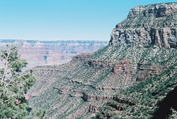
Havasupai Gardens and Plateau Point are just left of the centre.

--------------------------------------------------------------------------------------------------------

View of the South Rim cliff wall from Plateau Point.

----------------------------------------------------------------------------------------------------------
The Trail just past H. Gardens. Buddha Temple is ahead.

-------------------------------------------------------------------------------------------------------------
Looking into Bright Angel Canyon from Devil's Corkscrew.

-----------------------------------------------------------------------------------------------------------
View of Devil's Corkscrew from Plateau Point.

------------------------------------------------------------------------------------------------------
Gneiss Granite rock cliffs of Inner Gorge.

--------------------------------------------------------------------------------------------------------------
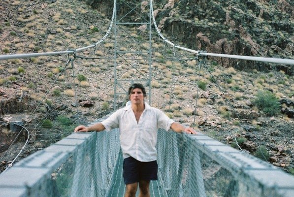
First view of the River.

------------------------------------------------------------------------------------------------------------
I took off my rucksack to pose on Silver Bridge.

-----------------------------------------------------------------------------------------------------------
Bright Angel Creek near Phantom Ranch. Facing Downstream.

--------------------------------------------------------------------------------------------------------------
Another view of Bright Angel Creek.

------------------------------------------------------------------------------------------------------------
Granite Rock feature, near Phantom Ranch.

------------------------------------------------------------------------------------------------------------
Mules in readiness, Phantom Ranch.

--------------------------------------------------------------------------------------------------------
Phantom Ranch.

-----------------------------------------------------------------------------------------------------------
At a Bridge crossing the Bright Angel Creek

------------------------------------------------------------------------------------------------------------
Brahman's Temple and Zoroaster Temple.

-----------------------------------------------------------------------------------------------------------
Fully suited and ready to go.

-------------------------------------------------------------------------------------------------------------

At the lowest point of the Canyon!

--------------------------------------------------------------------------------------------------------------
View of the River from Plateau Point.

---------------------------------------------------------------------------------------------------------------
Rock formation as seen from Plateau Point.

-------------------------------------------------------------------------------------------------------------
View of Cheops Pyramid from Plateau Point.


Saturday, 5 November 2022

Travel Biography - Week 21.

Grand Canyon Corridor - Overnight Information

Phantom Ranch is the only known rustic brick-and-mortar accommodation located at the bottom of the Grand Canyon amidst a copse of Cottonwood trees, aside from several campsites found along the Corridor and elsewhere. Consisting of a restaurant and several huts, in all, the Ranch accommodates up to 96 guests in different individual huts, nine of them accommodating up to four people, which includes ten mule riders, along with two larger huts for the Colorado River boat trippers and hiking parties, each with ten beds, and in addition, four hiker dormitories, each also containing ten beds of which two huts are for the male hikers, the other two for the female hikers.

Mules at Phantom Ranch.


In addition, the Bright Angel Campsite is close by, with 32 sites. If each of the tents accommodated two people, which looked to be the norm, then with 64 hikers under canvass, together with up to 96 guests at the ranch, this would make 160 people sleeping at the bottom of the Corridor region of the Grand Canyon during a typical night. Although, as you are probably aware by now, I love playing around with statistics, and this is no exception.

However, regarding the proportion of individual hikers making their way down to the River to spend the night, here I can only give estimates. In this case, it's established that at the height of summer, all places at the Ranch were, and are, fully booked several months before arrival. Likewise, on the riverboats, all places were fully taken months before the day they set sail, in addition, even up to a year before any rider mounted his mule for a two-day journey on the trails.

According to official statistics, in 1978, the year of my first visit, there were a total of 2,746,642 visitors, or 7,530 per day if I was to iron out the seasonal variations.

In 1995, the year of my second visit, there were 4,557,645 visitors, or 12,486 daily.

For the record, 2018 peaked with a total of 6,380,495 visitors pre-pandemic, with a daily average of 17,480.  

Therefore, with up to 160 people spending the night on the corridor floor in 1978, only 2% of all visitors spent the night there. However, among individual visitors who made it down as independent hikers, with as many as forty sleeping in the four large huts in the Ranch, along with a further 64 campers, a truer figure would have been less than 1.4%. However, what I had experienced at the Ranch in 1978, the percentage would be even less. Therefore, the estimated number of overnighters to the total number of daily visitors being at around 1% was confirmed later by a Ranch staff member on a YouTube video.

However, a far greater number of visitors were day hikers. On the Bright Angel Trail, the turnaround would more likely have been at the 1.5-mile rest stop, or at the three-mile rest stop further down, both having a bathroom and a water supply. This was my experience of hiking down the trail, especially in 1978 when many hikers were making their way up towards the Village, but after passing the three-mile stop, the Tonto Plateau area with Indian Gardens campsite was absolutely deserted. On the South Kabab Trail, Ooh-Ahh Point would have been a popular turnaround 1.8 miles into the hike.

What Happened at Phantom Ranch?

The 9.6-mile hike down Bright Angel Trail was made especially daunting by the cloud cover and a dry thunderstorm, along with a notice warning of life-threatening flash floods. Yet, at Indian Gardens, despite being all alone, the sight of Buddha Temple Butte directly in front, and to the left, Cheops Pyramid, transforming the Village view of the North Rim from a straight line making up the horizon to that of a mountain range looming ahead, making me realise the vast grandeur of the Canyon. Its grandeur was intensified when I continued the hike down the Devil's Corkscrew within the Inner Gorge, a canyon in its own right, the hard Vishnu Schist bedrock resulting in a much slower rate of erosion, thus a much narrower gorge whose walls loomed far above me.

Vishnu Schist bedrock near Phantom Ranch.


Eventually, shortly after crossing the Colorado River on Silver Bridge, I arrive at the Ranch, which, by then, it was rapidly getting dark as the night approached. After checking in at reception, I found the appropriate hut and entered. Inside were ten beds arranged in bunk form like that of a hostel dormitory. And like any hostel dorm, this hut was single-gender, assigned for male hikers. There was also a shower cubicle and lavatory, hence a bathroom just large enough to accommodate one person at a time. 

There were already three hikers in the hut. Two of them expressed surprise at my late arrival, but at least I was commended for completing the hike. These two were Americans, both a tad older than me, and both from Los Angeles, and the third hiker, a German of about my age or slightly younger, making his way into the shower cubicle. Only then I became aware of the presence of a shower in the hut.

And so, with four of us, there were still six beds remaining vacant, but I gave little thought about them. Presently, the German came out of the shower, and I thought it was the right moment to take advantage of the facility. Feeling refreshed, I sauntered out into the night and watched Bright Angel Creek as it flowed past the Ranch as it makes its way to join the Colorado River, a half-mile downstream from where I was standing. Meanwhile, I spotted the German hiker relaxing with his girlfriend as I unintentionally drew their attention. However, I just sauntered along.

It was when we all returned to the hut that it was agreed between all four of us that we would be up at four in the morning. The hike back up took about nine hours - twice the time it took for me to descend. An early start would take much of the heat out from hiking back up the Devil's Corkscrew. It was after we all settled in our beds that a discussion arose among us on why the other six beds remained unclaimed, and with all indications that they won't be claimed at all.

I could see that the American hikers were more irked by the presence of unclaimed beds than the German or me. In a huff, one of them spoke with a sneer.

I bet they have turned chicken and turned back to the Village!

I felt myself blush. Surely, I am a coward, too. The hiker's remark reminded me how fearful I felt whilst descending the Devil's Corkscrew with the high cliffs looming above, the thunderstorm, and the threat of flash floods, never mind the sense of loneliness, the cutting off from civilisation. In my own embarrassment, I didn't say a word. Instead, I made attempts to sleep. But not that well.

Bright Angel Creek is next to Phantom Ranch.


The Hike Back Up.

I couldn't blame the irk felt by the American hiker. Six beds in our hut remained unoccupied. And that was just our hut. How many more beds remained unclaimed? And this, whilst back at the rim, the number of potential hikers who walk away feeling downcast because there were no spare beds and no cancellations. Among the crowd of failed potential hikers, a few dared to break National Park regulations and hike down and sleep rough. The Two Frenchmen I passed near the end of my descent were a good example. Then again, the six empty beds might have been a group cancellation, with just me taking up one of the freed beds. A possibility, but very unlikely. Any on-the-day cancellations would have rapidly filled up.

I was the last one to leave the hut to step outside just as the first hint of a new day turned the sky from black into a velvety dark blue, as all the thunderclouds of the previous evening had dispersed. As I hit the trail, crossing Silver Bridge and taking a last look at the River dominated by Zoroaster Temple Butte, I saw all the other hikers ahead, all of them heading back up. And every hiker had at least one companion. There were also groups of three or even four. But the greater majority were in twos. I was the only lone hiker.

As I began to ascend the sweeping curves of the Devil's Corkscrew, the sunlight began to shine on the peaks of the surrounding buttes and pinnacles. They looked as if each one was uprooted and dipped into a huge can of glow paint. But I was grateful for the shade that covered the trail.

It was a while when I arrived at Indian gardens. By then, the shadows retreated as the sun rose, and I felt grateful whenever the trail passed through a shadow. But as the hike progressed, so the shadows slowly diminished, and I began to feel the heat of the sun.

Looking into Bright Angel Canyon from the Devil's Corkscrew.


In the sunshine, however, Tonto Plateau looked beautiful. Backed by the two dominant pinnacles on the north side of the River, the sun brought out the beauty of the pinkish-red sandstone topped with white limestone. Buddha Temple was so similar in shape to Zoroaster Temple, each consisting of a white limestone "head" resting on red sandstone "shoulders" - both shaped that way by the different rates of rock erosion - that I was confused, thinking at the time that I was constantly looking at just one butte. Actually, there were two, both looking very similar in shape and colour.

At the rest stop, several hikers were soaking their shirts in the cool refreshing water, but I hesitated to do the same, as I was concerned about the rucksack on my shoulders. So I just wet my face and proceeded on.

At last, the start of the most strenuous part of the entire Bright Angel hike, which is up the south wall of the Outer Gorge, leading to the Rim itself. Starting with Jacob's Ladder, a series of short, steep switchbacks at the lower part of the cliff, I no longer was walking at a steady pace, as I was doing all along. Instead, I would now walk several metres, then take a short break stop.

Further up, I had to stand aside and allow a train of mule riders to pass by as it descended the trail switchbacks. After the last mule passed by, it was one switchback after another in an unending sequence. Yet, despite the frequent breaks, I was determined to finish the hike entirely. I kept looking back at the North Rim edge. The line was beginning to straighten, but it seemed to take forever.

Further up, I had to stand aside again. This time it was for just three mules. The first beast carried the park ranger. The second mule carried a rucksack. The third mule carried an exhausted female hiker, looking as if bathed in shame and embarrassment at having to be rescued.

And that is precisely the deception the footpath can have. No wonder there are notices giving warnings of the severity of the Trail. Each year, up to 250 exhausted hikers are rescued, then have to pay a hefty fee for the rescue. In many of these cases, it's either an underestimation of the strenuousness of the hike, an overestimation of the hiker's ability, or both. Not to mention heatstroke, hyponatremia, sunburn or any other ailments one can fall into during the hike.

As the three mules carried on ahead, I continued to walk, then pause, and then walk. By then, the Trail is crowded, mainly with day hikers, but some were, like I did, preparing to settle for the coming night on the Canyon floor. The only difference was that they were setting off earlier in the day. As I progressed, some of the bystanders were cheering me on, as if I was a marathon runner approaching the finish line. One family cheered me on with gusto. It was very encouraging!

Cheops Pyramid is seen from the Devil's Corkscrew.


At last. At last! The trailhead came into view and I exited to amalgamate into the Village crowd, feeling very happy, exuberant, a sense of achievement. It was somewhere between 13.30 and 14.00 hours. Having set off from Phantom Ranch around 4.30 am, the authorities were spot on with the duration. With so many pause breaks taken on the final ascent, the return hike took nine hours to complete. This compares with the 4.5 hours for me to hike down the day before.

Nearing the exit of the Trail.


But also tired and exhausted. Along the South Rim, there were two benches facing each other. As I sat on one of them, I must have fallen asleep. When I woke up sometime later, the family who cheered me earlier whilst still hiking, was there and gave me further greetings as they reminded me that I have been sleeping for quite a spell.

---------------------------------------------------------------------------------------------------------
Next Week: Staying in a hotel with a questionable past.

Saturday, 29 October 2022

Travel Biography - Week 20.

Some Grand Canyon Information.

The Grand Canyon of the Colorado River is one of the World's Natural Wonders, and another is the Great Barrier Reef, off Queensland. I had the incredible privilege to visit both, the latter in 1997.

My first visit to the Grand Canyon was in 1978, and my second visit was in 1995. During my first visit, the Instamatic 110 camera, which I had at the time, failed to take proper photos of the experience. Therefore the need for another stop in the next convenient year, which was in 1995. Therefore, the photos included in this week's blog are from the 1995 visit. Since I will be concentrating on the 1978 visit, again, like last week, I apologise if you feel that the originality of this article was compromised.

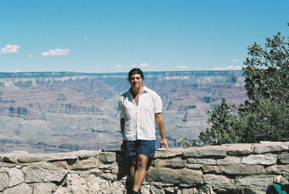
Grand Canyon 1995. In 1978, I looked a lot younger!


The Canyon is a 217-mile, 350 km long, steep-sided gash cut into the Colorado Plateau by the Colorado River. It's up to 18 miles, 29 km wide, and approx 1,600 metres, or over a mile deep. Because the whole of the Colorado Plateau, which extends into the States of Utah, Colorado, and New Mexico, as well as Arizona itself, slants towards the southerly direction, the North Rim, at 1,680 metres above the River, is about 300 metres higher than the South Rim which is approx 1,380 metres high. That means the UK's highest mountain, Ben Nevis in Scotland, peaking at 1,345 metres above sea level, if relocated inside the Grand Canyon, then both rims would look over the summit height of Ben Nevis.

Due to the southward slope of the Colorado Plateau, the River is considerably closer to the South Rim than the North Rim. This is due to the direction of the rainwater draining southwards, causing a greater rate of erosion of the north wall. Hence the mountains within the Canyon, knowns as buttes, along with the valleys separating them, are mainly on the north side of the river, thus the south wall, although lower than the north wall, is steeper.

One of the most remarkable features making up the Grand Canyon is the stratified layers of different rocks consisting of a horizontal, sandwich-like formation that applies to both rims and to all the buttes and the larger mesas within. The perfectly tidy yet distinct layers indicate that they were laid down by the water that once covered the area, a theory agreed upon by both secular geologists and Creationists alike.

Forming the upper rim edge is Kaibab Limestone. Below that is the Torroweap Formation. Next, the Coconino Sandstone rests on Hermit Shale. Below this, is the Supai Group of rock layers. Beneath is the Redwall Limestone. This rests upon Temple Butte Limestone, which itself lies on a layer of Muave Limestone. As the cliff lowers further still, next is Bright Angel Shale. Finally, Tapeats Limestone completes the upper section of the stratification. This series of layers, each bedding plane perfectly horizontal, was laid between 260 million years ago to 550 million years ago, according to secular geologists. However, beneath the Strata and forming the bedrock is the Vishnu Schist, along with Granite, both of volcanic origin which, according to geologists, was formed some 1.6 billion years ago.

Hence, where the water-laid Tapeats Sandstone meets the Vishnu Schist, there are around 550 million years of rock layers missing. This is known as the Great Unconformity. Yet the bedding plane between the Schist and the sandstone looks as normal and without incident as all the other layers above.

South Rim View. Tonto Plateau is centre-left.


Grand Canyon in the evening.


Grand Canyon Village on the South Rim marks the location of the Bright Angel Trailhead. This path, known as the Bright Angel Trail, is 9.6 miles, 15.5 km in length as it reaches Phantom Ranch on the floor of the Canyon. The Ranch is located a half-mile inside the mouth of Bright Angel Canyon, a side gorge leading up to the North Rim. Bright Angel Creek flows through it to join the Colorado River, a short way downstream from the Ranch. A couple of miles east of the Village, South Kaibab Trailhead begins a 7-mile trail which eventually joins the Bright Angel Trail at Phantom Ranch, then continues on for another 16 miles as North Kaibab Trail to the North Rim. Thus, this Y-shape trail configuration is known as the Corridor, and it's this part of the Canyon that's gazed upon by countless numbers of visitors at and around the Village.

Arrival at the Canyon Village.

Having arrived at the South Rim after a two-hour bus ride from Flagstaff, I was taken aback by the sight. Spread before me, was the Canyon in all its splendour. The North Rim appeared as a straight line on the horizon, totally unaware that it was at a higher elevation than where I was standing. When I arrived there in 1978, I knew virtually nothing about the Canyon. Thus, the information I can provide was learned since I visited the National Park, and not whilst there or beforehand.

Grand Canyon Village.


My plan was to spend just the day at the South Rim, absorb the glory into my memory and camera alike, and then return to Flagstaff to resume the long journey to Los Angeles. In the meantime, even as an untrained eye, I could make out, far away, what looks like a long side Canyon leading away from us and towards the North Rim, it was later that I learned that this was Bright Angel Canyon, a tributary of the Inner Gorge in which the Colorado River flows. On either side and below eye level, I would have looked at Buddha Temple Butte directly in front, to the left of it, Cheops Pyramid, with Isis Temple Butte just behind it. On the other side of the tributary gorge, Zoroaster Temple Butte dominates with Brahman Temple Butte next to it.

All these features were on the other side of the River, hidden from view at the Village area of the South Rim. If one is mystified by such Eastern names, then it was Clarence Dutton, a mid-19th Century geologist who had an interest in Eastern religions, who gave names to these pinnacles as he surveyed the Canyon.

At Indian Gardens on the Tonto Plateau.


Off from the South Rim and from where I stood, a small pinnacle, known as Battleship Rock overlooks Tonto Plateau, a level shelf of Bright Angel Shale on which Indian Gardens sits. A side trail branching off the Bright Angel Trail leads to Plateau Point, adding 1.5 miles to an Inner Gorge overlook over the River which is directly below, and the first sight of it after a downhill hike from the Village. Had I known about the South Kaibab Trailhead a few miles east of the village, I would have been taken aback by the impressive O'Neil Butte leading off the South Rim near Yaki Point.

Preparing for the Hike.

As I strolled west, I came across what looked like the start of a trail leading down into the Canyon. A flash of excitement took hold of me as I watched one tired and sweaty hiker after another reaching the end of their journey, exiting the trail and arriving back into the safety of the Village. This, I learned, was the Bright Angel Trailhead, and this was the most popular of all hiking trails within the national park.

I approached Bright Angel Lodge, which wasn't far from the trailhead, to ask more about the trail. The lady at the counter quickly responded that she had just received a cancellation at Phantom Ranch, and a bed has become available on the Canyon floor. Asking me if I would take it, without hesitation, I said, "Yes, yes, yes!" And so, I bought a bed reservation ticket, and my plan for the day instantly changed. My luggage will now have to spend a second night at Flagstaff Bus Station as I made my way to a nearby kiosk to hire a rucksack, the first one I ever wore over my shoulders, and a pair of hiking boots, both items marking a start to something of a personal revolution for future travel. I then found the site superstore, and in it, I bought various items for the coming hike. It was a while later, as clouds were gathering in the sky, that I set off on my hike down into the Canyon.

Zoroaster Temple Butte dominates the River.


As I zig-zagged down the cliff switchbacks, I encountered more and more hikers coming the other way. One of them even stopped me and asked if I had a Camper's Pass. I answered that I had a reservation ticket for Phantom Ranch which I showed him. He then let me go with a wish of good luck.

The switchbacks continued, back and forth, rounding bends as I descended the south wall. It wasn't too long before Battleship Rock towered over me. From the Rim, this pinnacle was way below me. Now I was below it. And from this angle, the rock actually resembles a ship. 

By the time the footpath began to level out at the start of Tonto Plateau, three miles into the hike, the area was deserted. There were no more hikers coming the other way. One can say that the Tonto Plateau resembles a large field, possibly a meadow. Yet, the sky was overcast and a peal of thunder rolled across the valley. I was alone, all alone in the strange environment. I paused to look around. Looming behind me were the high cliffs of stratified rocks topped by the South Rim. In front, the straight line of the North Rim has distorted, with Buddha Temple Butte now towering over me, along with Cheops Pyramid to the left of it. Nearby was a notice warning of flash floods in the area that can endanger lives. Wow! Just what I need. Alone in the desert, a clap of thunder rolled and fear gripped me. But would I turn back? No! Instead, I was determined to press on with the hike.

I approached Indian Gardens which had a rest stop with a water tap. A good source of refreshment. It was here, too, that the trail divided, with the Plateau Point path branching off to my left. Presently, the trail began to plunge into the Inner Gorge in a series of lengthy curved switchbacks known as the Devil's Corkscrew. Another thunderclap rolled, but at least it wasn't raining. As I again paused to look around, the high cliffs of the harder Vishnu Schist volcanic rock loomed high, making me feel like a tiny dwarf. I suppose this was why the Inner Gorge was considerably narrower than the Outer Gorge. The harder the rock, the slower the rate of erosion.

Bright Angel Creek.


Unlike at Tonto Plateau, here, near the bottom of the Canyon, the whole area was buzzing with life. Countless numbers of crickets were chirping in the bushes, their combination creating a continuous hum, backed by rolling thunder. It was quite a fascinating scene as I walked on.

After a while, about eight miles into the hike, I approached a hut. Two young men were looking as if preparing a meal on a camping skillet. Feeling relieved at the sight of another human, I called out as I approached the hut.

The two men, whom I could see were Frenchmen, warmly welcomed me into their company. We talked and I too was served a portion of their dinner. They said that they couldn't reserve a bed at the Ranch, so they decided to settle down here in the hut for the night, where it would be unlikely to be spotted by a passing ranger. After thanking them, I was preparing to leave, to complete the final leg of the hike. They begged me to stay for the night with them. Despite how tempted I might have felt to remain with them, my desire to finish the hike was stronger, and they had to let me go, but not without expressing my gratefulness.

It was the right decision. I rounded a bend and lo! There was the River, flowing at speed through the Grand Canyon. The trail, officially known as the River Trail but very much Bright Angel still, hugged the riverside as it wounded its way along the irregular surface of the Vishnu Schist valley. 

As I looked ahead, the looming shape of Zoroaster Temple Butte began to dominate the sky above the River. Resembling a white limestone head resting on red sandstone shoulders, this mountain, or so I thought, was all left of the North Rim. What a difference from when I looked at it from the Village! From there, the North Rim was a straight line making up the horizon. Down here, all that was left of it was a solitary mountain peak surrounded by the sky. At the time, I was still unaware that what I was looking at was a butte, a pinnacle rising well inside the Canyon, and not actually part of the North Rim, even though the butte is on the north side of the River.

As I was walking towards the butte, another appeared from behind the valley bend. This was Brahman Temple Butte, although roughly the same height as Zoroaster, it was much more stout in appearance.

Presently, Silver Bridge, one of only two that cross the Colorado River with the Canyon, appeared, just as it was getting dark. Silver Bridge was to first one to appear. The second one, Black Bridge, was about a mile further on and served the South Kaibab Trail before the twain joined Phantom Ranch to become the North Kaibab Trail leading to the North Rim.

Phantom Ranch.


Eventually, after another half-mile within the mouth of Bright Angel Canyon, I approached Phantom Ranch with its number of huts amidst a copse of Cottonwood trees. Nearby, the creek of the same name as the valley it flows through, gurgled along its course to join the Colorado River at the mouth of the gorge. The Ranch is classified as a hotel, with a restaurant house and eleven separate cabins, nine of them accommodating up to four people whilst the other two cabins took in ten guests, one for men and the other for females. At the Ranch reception, I handed in the reservation ticket and I was given the key to one of the larger cabins. When I got there, I saw that there was a young German hiker and two American hikers, making, so far, four occupants. We were to wait for the other six. 

After the German had a shower and then left the cabin to join his girlfriend outside, it was my turn to take a refreshing shower. After this, I took a stroll around the site before retiring to bed. The two American hikers, whom I found out lived in Los Angeles, the German, and I, all waited for the occupants of the remaining six beds to arrive. So far, no one else entered our cabin.

----------------------------------------------------------------------------------------------------------
Next Week: A Test of Endurance.

Saturday, 3 November 2018

A Lesson From a Cheap Camera.

One fascinating thing about having friends on social websites such as Facebook is that many would share their photo albums on past travel experiences, and observers like myself can enjoy a moment of nostalgia, having fond memories of my own experiences at the same venue.

As such, a new website friend, Dave Betts, who has recently arrived as a newcomer at our church in Ascot and has raised my hopes for a "proper" face-to-face friendship, has on his photo page an album featuring his visit to the Grand Canyon with two other mates of his, a trip made within the last three years or so. One picture shows him sitting precariously on a narrow ledge above what looks like a sheer drop into the abyss below. I have to admit, such posing at such a dynamic background makes for fascinating photography - one which would qualify for any magazine publication or display at an art gallery.  

All three were definitely having a whale of a time! And as Dave himself commented, this particular trip fulfilled his life-long dream of wanting to see the Grand Canyon for himself. And so the trio hired a car, most likely using the FlyDrive scheme, where car hire is purchased together with the air ticket, thought up by the travel industry for the benefit of British and European tourists who desire an independent trip around the States.

Grand Canyon from near Kolb Studio, 1995.


Which, to me anyway, is very different from the escorted tours available. Indeed, there are many who prefer the comfort which comes with such holidays, free from any personal responsibilities. But the trouble with such ranger-led trips is that the keeping of tight schedules can cramp such experiences, such, for example, had emanated from one couple arriving at the South Rim on such a tour:

You have twenty minutes, the escort announced to all as the tourists alighted from the coach. As one couple was spending their precious moments enamoured by the displays at the Visitor's Center, suddenly one of them, the wife, I think, shouted, 
Heavens! We have only five minutes left! 

Quickly they dashed to the rim in time to take a quick look at the magnificent work of nature before compelled to return to the waiting coach and continue on with the journey. Unbelievable? Maybe so, but I actually read the account in either National Geographic or The Rough Guide to the Grand Canyon some years ago, so it must be true. It's the sort of thing that makes me feel aghast about such tours - as if time and money spent on them were more important to the company responsible than the sense of fulfilment felt by the tourist, to which such companies are obliged to meet.

However, unlike Dave Betts and his mates, I couldn't take advantage of the FlyDrive scheme which was so popular in my day, as I don't hold a driving licence. But back in 1978, once again I bought an air ticket along with the go-as-you-please Greyhound Bus Ameripass ticket, a document which allowed unlimited travel across the USA on the bus for a fixed period, which for me was four weeks. This time, I was determined to visit the Grand Canyon National Park, after having missed it on my first ever transatlantic trip a year earlier in 1977. It was also on this initial trip where on the flight from London to Toronto that something went horribly wrong.

At Indian Gardens, Tonto Plateau, 1995.


It was the moment, shortly after take-off, that I wanted to capture a fascinating scene of the Scottish landscape under a clear sky from my window seat. And that's when the camera shutter suffered permanent failure. It was my Dad's camera given to me, a type 120 which was housed in a metal casing complete with a leather jacket, and used a paper-backed spooled film which captures negative images 2.25" square. He had it for years, right from my boyhood days. What? On a transatlantic flight with no camera? Therefore, once landed in Toronto and having found a suitable hotel, the first shop I called was at a photography outlet. There I bought a cheap 110 pocket Instamatic which was housed entirely in plastic and captures images at just 13mm by 17mm in size. The resulting pics taken were generally okay, although with soft detail outlines which gives the impression of being very slightly out of focus. 

The following year, in 1978, I took the same pocket Instamatic for the second transatlantic flight specifically to visit the Grand Canyon. After landing in New York and settling down at a seedy-looking hotel in the heart of Manhatten, again with a Greyhound Bus Ameripass, I began my journey towards Flagstaff in Arizona, stopping at various cities along the way.  At my arrival at four in the morning local time at this quiet settlement, I discovered that I have just entered the Pacific Time Zone from Mountain Time Zone, therefore I felt discouraged at the extra hour I had to wait alone during the small hours at the otherwise deserted bus terminal for the special Greyhound Bus to Grand Canyon Village on the South Rim.

During that wait, I was meant to spend just a day at the Canyon, so I deposited my luggage at a left-locker located in the waiting room. By 7.30 am I boarded the bus, expecting to return by nightfall before continuing the journey overnight to Los Angeles.

Looking North into Bright Angel Canyon, 1995


Upon arrival, I was struck by the sheer size, beauty and dynamism of the Canyon! As I looked down upon the buttes consisting of sedimentary strata, mainly of sandstone and limestone, I knew straight away that these rocks were laid by water before the river cut into the plateau to form this huge gorge. A testimony to Noah's Flood? As I walked along the rim, I noticed hikers going down and coming up a trail, which head was close to Kolb Studios set at the rim's edge. Therefore through inquiry, I discovered that I could reserve a bed for myself at the desk at Bright Angel Lodge for Phantom Ranch way down below. Bright Angel Lodge is also close by to the trailhead, which shares the same name as the Lodge itself.

Wow! A cancellation at one of the Phantom Ranch dormitories allowed me to buy a reservation ticket. Suddenly, the whole plan of the day changed. I was not to return to Flagstaff that evening. Instead, I'll be spending that night at the Ranch, which is located a little way north of the Colorado River, and also where Bright Angel Creek joins the main river after flowing from a spring close to the North Rim. Because I wanted to take in the grandeur of the Canyon from the South Rim, as well as explore the village and Visitor's Center, I stayed at the Rim longer than I should have done.

And so by late afternoon, after hiring a rucksack and packing it with suitable eats as well as a gallon of drinking water bought at a nearby superstore, I started to make my way down Bright Angel Trail, just as the blue sky turned into a grey overcast. It is interesting, coming to think of it, as I hiked rapidly down the switchbacks, also known as Jacob's Ladder, I noticed the vast majority of walkers were heading the other way, out of the Canyon. In fact, I would not be exaggerating (or understating) that I was the only one going down. Everyone else was coming up. One hiker even stopped me to ask whether I had a Camper's Pass. I explained that I had a reservation for Phantom Ranch. He looked satisfied and allowed me to proceed.

By the time I arrived at Tonto Plateau - the level shelf halfway into the Canyon where Indian Gardens Campground was also located - I was entirely alone. This is because, as I learned later, that the vast majority of visitors purposely don't make it to the bottom. A large number of walkers make it to the 1.5-mile rest station and then turn back. Far fewer proceed to the 3-mile station, which is at the foot of the South Rim cliff. The majority who do then turn back up. This leaves a small percentage of hikers who continue on. Hence my isolation at Indian Gardens, just as a thunder rolled overhead.

Nearby was a notice warning of flash floods that can endanger hikers. Wow! Exactly what I wanted to read! Now for the first time, I felt a tinge of fear. But I walked on, with the magnificent splendour of Buddha Temple butte towering directly in front of me, and Cheops Pyramid butte to the left of it, backed by the wall of the North Rim. The trail divided at this point. One branched off to Plateau Point, on the edge of the Inner Gorge, from where a dramatic view of the River can be seen directly from above, as it cuts through gneiss and granite bedrock upon which the sedimentary strata sit. I stayed on the main trail, which plunges into the Inner Gorge by means of switchbacks known as the Devil's Corkscrew.

As the massive walls of the Inner Gorge towered over me, the thunder continued to roll, but there was hardly any rain. If ever there was a time I felt alone and cut off from the world this was it. By the time I got to the bottom, there was a constant hum of bugs, millions of them, such as crickets, filling the air with such a rich sound. Eventually, I came across a hut with a couple of humans milling about. What a massive relief it was to see another human!

Deep in the Devil's Corkscrew, 1995.


I called out, and seeing me approaching (as their hut was by the trail) they invited me in. They offered me some refreshment and begged me to stay the night with them. They were French hikers, and although communication was difficult, we certainly were able to make our thoughts known. However, I declined their invitation. Not only did I suspect what they were doing was possibly illegal to National Park rules, but I also felt determined to finish the hike properly. Therefore I bade them farewell.

The trail rounded a bend and I found myself right next to the River as it was getting dark. The trail continued alongside, with the towering view of Zoroaster Temple Butte, on the North side of the river, yet seen from here as directly in front.

I crossed the River at Silver Bridge, one of only two which crosses the River and I eventually made my way into Phantom Ranch reception to claim my bed at one of the single-gender dormitory huts. The other occupants consisted of a young German, whose girlfriend slept in another hut reserved for females. And there were two "locals" - hikers from Los Angeles, and two vacant beds. Considering the intense demand for these beds, with many potential hikers turned away at the booking desk at Bright Angel Lodge, it was no surprise that later that night, after we were all in bed and still awaiting the new arrivals, a discussion arose to why these beds remained unoccupied.

Therefore here is an extract from the diary I kept of the entire trip:

"They most likely turned chicken and turned back to the village", one of the Californians sneered.
I lay in bed, grateful for the darkness hiding my embarrassment. Because I too am a coward. How could I forget the fear I felt whilst alone further back (at the Devil's Corkscrew?)

As we all (at the Ranch) set off the next morning, watching the clear waters of Bright Angel Creek flow non-stop to the Colorado River, the camera shutter was constantly clicking. One picture after another. The dawn scene deep in the Canyon was indeed a fascinated sight. How the outlines of the surrounding buttes made a contrast to the clear sky above, along with the sound of the rushing River.

Zoroaster Butte dominates River, 1995.


I finally arrived at the village after nine hours of hiking to the Rim from the Ranch, with the last three hours so torturous as the rucksack weighed on my back whilst ascending the Jacob's Ladder switchbacks.

It was after I arrived back home and had the film developed when I felt intense disappointment! All the snapshots of the Inner Gorge failed to come out properly - just dark, black silhouettes breaking a velvety sky along with a poor reflection from the River.

It was a horrible disappointment. Like if a mission I set off to had failed in its accomplishment. It was a very hard lesson to learn. That is, never set off on such trips with a cheap camera. I was just asking for trouble.

All this played on my mind for the next seventeen years. During that time I was made redundant from the engineering job I had, and I started my window cleaning business, which I kept going successfully for the next 35 years. But the thought of re-visiting the Grand Canyon to complete my "original mission" was always on the front of my mind. 

1995 arrived, and with it, another backpacking trip to the USA, this time taking with me a better camera, the type 135, then the standard cartridge film throughout the nineties. Again, the same trail was used, but instead of the storm, the sky remained clear into the night, giving the most fantastic astronomical display I have ever seen. And true to form, snapshots of the Inner Gorge and River came out far better than the originals.

As the Psalm goes:

Oh Lord,
How manifold are thy works!
In wisdom hast thou made them all:
The Earth is full of thy riches.
Psalm 104:24.