Some Grand Canyon Information.
The Grand Canyon of the Colorado River is one of the World's Natural Wonders, and another is the Great Barrier Reef, off Queensland. I had the incredible privilege to visit both, the latter in 1997.
My first visit to the Grand Canyon was in 1978, and my second visit was in 1995. During my first visit, the Instamatic 110 camera, which I had at the time, failed to take proper photos of the experience. Therefore the need for another stop in the next convenient year, which was in 1995. Therefore, the photos included in this week's blog are from the 1995 visit. Since I will be concentrating on the 1978 visit, again, like last week, I apologise if you feel that the originality of this article was compromised.
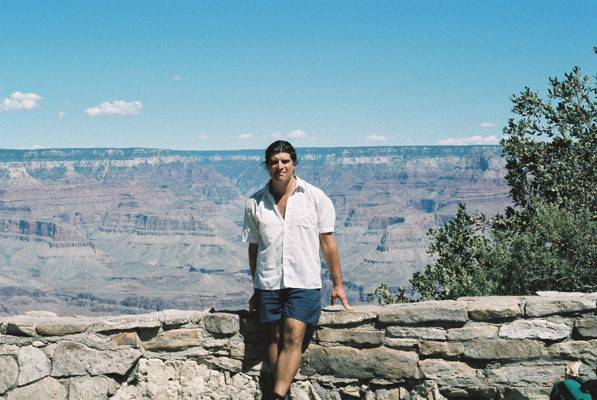 |
| Grand Canyon 1995. In 1978, I looked a lot younger! |
The Canyon is a 217-mile, 350 km long, steep-sided gash cut into the Colorado Plateau by the Colorado River. It's up to 18 miles, 29 km wide, and approx 1,600 metres, or over a mile deep. Because the whole of the Colorado Plateau, which extends into the States of Utah, Colorado, and New Mexico, as well as Arizona itself, slants towards the southerly direction, the North Rim, at 1,680 metres above the River, is about 300 metres higher than the South Rim which is approx 1,380 metres high. That means the UK's highest mountain, Ben Nevis in Scotland, peaking at 1,345 metres above sea level, if relocated inside the Grand Canyon, then both rims would look over the summit height of Ben Nevis.
Due to the southward slope of the Colorado Plateau, the River is considerably closer to the South Rim than the North Rim. This is due to the direction of the rainwater draining southwards, causing a greater rate of erosion of the north wall. Hence the mountains within the Canyon, knowns as buttes, along with the valleys separating them, are mainly on the north side of the river, thus the south wall, although lower than the north wall, is steeper.
One of the most remarkable features making up the Grand Canyon is the stratified layers of different rocks consisting of a horizontal, sandwich-like formation that applies to both rims and to all the buttes and the larger mesas within. The perfectly tidy yet distinct layers indicate that they were laid down by the water that once covered the area, a theory agreed upon by both secular geologists and Creationists alike.
Forming the upper rim edge is Kaibab Limestone. Below that is the Torroweap Formation. Next, the Coconino Sandstone rests on Hermit Shale. Below this, is the Supai Group of rock layers. Beneath is the Redwall Limestone. This rests upon Temple Butte Limestone, which itself lies on a layer of Muave Limestone. As the cliff lowers further still, next is Bright Angel Shale. Finally, Tapeats Limestone completes the upper section of the stratification. This series of layers, each bedding plane perfectly horizontal, was laid between 260 million years ago to 550 million years ago, according to secular geologists. However, beneath the Strata and forming the bedrock is the Vishnu Schist, along with Granite, both of volcanic origin which, according to geologists, was formed some 1.6 billion years ago.
Hence, where the water-laid Tapeats Sandstone meets the Vishnu Schist, there are around 550 million years of rock layers missing. This is known as the Great Unconformity. Yet the bedding plane between the Schist and the sandstone looks as normal and without incident as all the other layers above.
 |
| South Rim View. Tonto Plateau is centre-left. |
 |
| Grand Canyon in the evening. |
Grand Canyon Village on the South Rim marks the location of the Bright Angel Trailhead. This path, known as the Bright Angel Trail, is 9.6 miles, 15.5 km in length as it reaches Phantom Ranch on the floor of the Canyon. The Ranch is located a half-mile inside the mouth of Bright Angel Canyon, a side gorge leading up to the North Rim. Bright Angel Creek flows through it to join the Colorado River, a short way downstream from the Ranch. A couple of miles east of the Village, South Kaibab Trailhead begins a 7-mile trail which eventually joins the Bright Angel Trail at Phantom Ranch, then continues on for another 16 miles as North Kaibab Trail to the North Rim. Thus, this Y-shape trail configuration is known as the Corridor, and it's this part of the Canyon that's gazed upon by countless numbers of visitors at and around the Village.
Arrival at the Canyon Village.
Having arrived at the South Rim after a two-hour bus ride from Flagstaff, I was taken aback by the sight. Spread before me, was the Canyon in all its splendour. The North Rim appeared as a straight line on the horizon, totally unaware that it was at a higher elevation than where I was standing. When I arrived there in 1978, I knew virtually nothing about the Canyon. Thus, the information I can provide was learned since I visited the National Park, and not whilst there or beforehand.
 |
| Grand Canyon Village. |
My plan was to spend just the day at the South Rim, absorb the glory into my memory and camera alike, and then return to Flagstaff to resume the long journey to Los Angeles. In the meantime, even as an untrained eye, I could make out, far away, what looks like a long side Canyon leading away from us and towards the North Rim, it was later that I learned that this was Bright Angel Canyon, a tributary of the Inner Gorge in which the Colorado River flows. On either side and below eye level, I would have looked at Buddha Temple Butte directly in front, to the left of it, Cheops Pyramid, with Isis Temple Butte just behind it. On the other side of the tributary gorge, Zoroaster Temple Butte dominates with Brahman Temple Butte next to it.
All these features were on the other side of the River, hidden from view at the Village area of the South Rim. If one is mystified by such Eastern names, then it was Clarence Dutton, a mid-19th Century geologist who had an interest in Eastern religions, who gave names to these pinnacles as he surveyed the Canyon.
 |
| At Indian Gardens on the Tonto Plateau. |
Off from the South Rim and from where I stood, a small pinnacle, known as Battleship Rock overlooks Tonto Plateau, a level shelf of Bright Angel Shale on which Indian Gardens sits. A side trail branching off the Bright Angel Trail leads to Plateau Point, adding 1.5 miles to an Inner Gorge overlook over the River which is directly below, and the first sight of it after a downhill hike from the Village. Had I known about the South Kaibab Trailhead a few miles east of the village, I would have been taken aback by the impressive O'Neil Butte leading off the South Rim near Yaki Point.
Preparing for the Hike.
As I strolled west, I came across what looked like the start of a trail leading down into the Canyon. A flash of excitement took hold of me as I watched one tired and sweaty hiker after another reaching the end of their journey, exiting the trail and arriving back into the safety of the Village. This, I learned, was the Bright Angel Trailhead, and this was the most popular of all hiking trails within the national park.
I approached Bright Angel Lodge, which wasn't far from the trailhead, to ask more about the trail. The lady at the counter quickly responded that she had just received a cancellation at Phantom Ranch, and a bed has become available on the Canyon floor. Asking me if I would take it, without hesitation, I said, "Yes, yes, yes!" And so, I bought a bed reservation ticket, and my plan for the day instantly changed. My luggage will now have to spend a second night at Flagstaff Bus Station as I made my way to a nearby kiosk to hire a rucksack, the first one I ever wore over my shoulders, and a pair of hiking boots, both items marking a start to something of a personal revolution for future travel. I then found the site superstore, and in it, I bought various items for the coming hike. It was a while later, as clouds were gathering in the sky, that I set off on my hike down into the Canyon.
 |
| Zoroaster Temple Butte dominates the River. |
As I zig-zagged down the cliff switchbacks, I encountered more and more hikers coming the other way. One of them even stopped me and asked if I had a Camper's Pass. I answered that I had a reservation ticket for Phantom Ranch which I showed him. He then let me go with a wish of good luck.
The switchbacks continued, back and forth, rounding bends as I descended the south wall. It wasn't too long before Battleship Rock towered over me. From the Rim, this pinnacle was way below me. Now I was below it. And from this angle, the rock actually resembles a ship.
By the time the footpath began to level out at the start of Tonto Plateau, three miles into the hike, the area was deserted. There were no more hikers coming the other way. One can say that the Tonto Plateau resembles a large field, possibly a meadow. Yet, the sky was overcast and a peal of thunder rolled across the valley. I was alone, all alone in the strange environment. I paused to look around. Looming behind me were the high cliffs of stratified rocks topped by the South Rim. In front, the straight line of the North Rim has distorted, with Buddha Temple Butte now towering over me, along with Cheops Pyramid to the left of it. Nearby was a notice warning of flash floods in the area that can endanger lives. Wow! Just what I need. Alone in the desert, a clap of thunder rolled and fear gripped me. But would I turn back? No! Instead, I was determined to press on with the hike.
I approached Indian Gardens which had a rest stop with a water tap. A good source of refreshment. It was here, too, that the trail divided, with the Plateau Point path branching off to my left. Presently, the trail began to plunge into the Inner Gorge in a series of lengthy curved switchbacks known as the Devil's Corkscrew. Another thunderclap rolled, but at least it wasn't raining. As I again paused to look around, the high cliffs of the harder Vishnu Schist volcanic rock loomed high, making me feel like a tiny dwarf. I suppose this was why the Inner Gorge was considerably narrower than the Outer Gorge. The harder the rock, the slower the rate of erosion.
 |
| Bright Angel Creek. |
Unlike at Tonto Plateau, here, near the bottom of the Canyon, the whole area was buzzing with life. Countless numbers of crickets were chirping in the bushes, their combination creating a continuous hum, backed by rolling thunder. It was quite a fascinating scene as I walked on.
After a while, about eight miles into the hike, I approached a hut. Two young men were looking as if preparing a meal on a camping skillet. Feeling relieved at the sight of another human, I called out as I approached the hut.
The two men, whom I could see were Frenchmen, warmly welcomed me into their company. We talked and I too was served a portion of their dinner. They said that they couldn't reserve a bed at the Ranch, so they decided to settle down here in the hut for the night, where it would be unlikely to be spotted by a passing ranger. After thanking them, I was preparing to leave, to complete the final leg of the hike. They begged me to stay for the night with them. Despite how tempted I might have felt to remain with them, my desire to finish the hike was stronger, and they had to let me go, but not without expressing my gratefulness.
It was the right decision. I rounded a bend and lo! There was the River, flowing at speed through the Grand Canyon. The trail, officially known as the River Trail but very much Bright Angel still, hugged the riverside as it wounded its way along the irregular surface of the Vishnu Schist valley.
As I looked ahead, the looming shape of Zoroaster Temple Butte began to dominate the sky above the River. Resembling a white limestone head resting on red sandstone shoulders, this mountain, or so I thought, was all left of the North Rim. What a difference from when I looked at it from the Village! From there, the North Rim was a straight line making up the horizon. Down here, all that was left of it was a solitary mountain peak surrounded by the sky. At the time, I was still unaware that what I was looking at was a butte, a pinnacle rising well inside the Canyon, and not actually part of the North Rim, even though the butte is on the north side of the River.
As I was walking towards the butte, another appeared from behind the valley bend. This was Brahman Temple Butte, although roughly the same height as Zoroaster, it was much more stout in appearance.
Presently, Silver Bridge, one of only two that cross the Colorado River with the Canyon, appeared, just as it was getting dark. Silver Bridge was to first one to appear. The second one, Black Bridge, was about a mile further on and served the South Kaibab Trail before the twain joined Phantom Ranch to become the North Kaibab Trail leading to the North Rim.
 |
| Phantom Ranch. |
Eventually, after another half-mile within the mouth of Bright Angel Canyon, I approached Phantom Ranch with its number of huts amidst a copse of Cottonwood trees. Nearby, the creek of the same name as the valley it flows through, gurgled along its course to join the Colorado River at the mouth of the gorge. The Ranch is classified as a hotel, with a restaurant house and eleven separate cabins, nine of them accommodating up to four people whilst the other two cabins took in ten guests, one for men and the other for females. At the Ranch reception, I handed in the reservation ticket and I was given the key to one of the larger cabins. When I got there, I saw that there was a young German hiker and two American hikers, making, so far, four occupants. We were to wait for the other six.
After the German had a shower and then left the cabin to join his girlfriend outside, it was my turn to take a refreshing shower. After this, I took a stroll around the site before retiring to bed. The two American hikers, whom I found out lived in Los Angeles, the German, and I, all waited for the occupants of the remaining six beds to arrive. So far, no one else entered our cabin.
----------------------------------------------------------------------------------------------------------
Next Week: A Test of Endurance.
Brings back some great memories of my visit to the canyon. An interesting read. Cheers, Paul
ReplyDeleteDear Frank, Thank you for the great post, which I especially enjoyed as it reminded me of our two trips to Grand Canyon. We did a long hike on the Bright Angel trail -- not anywhere close to the bottom, though! My parents did a donkey ride to the bottom on their honeymoon. and my mom said she was terrified!
ReplyDeleteBlessings to you and Alex,
Laurie