Introduction to the Photo album of our 1992 Lake District Hiking Trip.
In 1992, two years after completing the John O'Groats to Land's End bicycle ride across Great Britain, Gareth and I agreed to visit the Lake District more thoroughly. This would involve hiking rather than cycling and would include visits to areas that would have been impossible to reach on a bicycle. The peaks of Helvellyn and Scafell Pike were two examples of foot-only access.
The Lake District is a National Park, the UK's second largest after the Cairngorms NP in the Scottish Highlands and the largest in England, covering 566,124 acres. The weather there is quite varied, having one of the highest annual rainfall in the United Kingdom. Gareth and I were thoroughly soaked one afternoon as we approached Keswick after walking along a trail which skirted the west side of Lake Derwentwater from our hostel with the same name.
Yet, despite the varied weather conditions, the Lake District, in our opinion, brings out the natural beauty of the UK, although modest in comparison with the more dramatic scenery found elsewhere around the world. The Park has England's highest mountain, Scafell Pike, at 978 metres or 3,029 feet high. But in Wales, its highest peak, Mt Snowdon, is 1,085 metres in height, which is a difference of 107 metres. But it's Scotland that boasts the highest mountain in the United Kingdom, Ben Nevis of the Grampians at 1,345 metres or 4,413 feet. That's a difference of 367 metres between Ben Nevis and Scafell Pike.
Is any of this relevant? I think it is. In 1993, Gareth, along with Tim - at that time two of my closest Christian friends - took on the challenge of ascending all three mountains within 24 hours. And I'm glad to say that they succeeded. Gareth in particular was a marathon runner during the late eighties and early nineties, and it was not that surprising that he was a stronger hiker than I was. In turn, Tim was both a team manager and a player in a local football team. As for me, I wasn't around to partake in the challenge, as at the time I was in Israel.
However, what makes the Lake District so unique is the number of lakes and tarns occupying the valleys separating the mountains. Seen from a pilot's eye view, the lakes are roughly arranged like the spokes of a wheel radiating outwards from a centre point, namely in the Grasmere area. Whilst the lakes are generally ribbon-shaped, tarns are generally more oval areas of water occupying a hollow and fed by a stream with another stream flowing out of it, hence, the tarn retains its depth throughout. Unlike the lakes, tarns could nestle high above sea level and within a mountain peak such as Helvellyn. Here, from the summit of this mountain, we gazed down at Red Tarn, the National Park's highest body of water, 718 metres or 2,356 feet above sea level.
In turn, Lake Windermere is not only the lowest lake in the park at 130 feet or just under 40 metres above sea level, but it's also the largest lake in England, over 10 miles in length and up to a mile wide. It's also the most commercialised lake, with cruisers plying its ribbon-length, along with rowing boat hire, canoes, and even swimmers. The largest provincial YHA hostel in the UK, Ambleside, has a jetty leading to its shoreline at the northern tip of the lake, where cruisers make regular calls. YHA Ambleside is second in size only to East London's YHA Rotherhithe.
After a journey on the National Express Bus from London Victoria to Windermere, we haven't worked out how many miles we covered during our two-week holiday at the Lakes, but generally, we walked from Windermere to Keswick and back, and our 14 nights were spent in nine different hostels, with the longest stay at Longthwaite Hostel, where we spent three nights consecutively. Longthwaite was our base for the Scafell Pike climb. Roughly speaking, the distance on foot between Windermere and Keswick towns averages 23 miles, but is by road. We stuck with trails as much as we could and with plenty of diversions, mountain hiking, and loops, we could easily say that we covered around fifty or sixty miles in total. But then again, that's only an estimate.
And the figure includes "dead walks" - like our first attempt to climb Scafell Pike. The sky was overcast and the mountain disappeared into the low cloud. So, after heading someway up, we turned back. The next day, the sky was still overcast, but we were more determined to complete the climb. When we did, we were richly rewarded when the cloud began to lift, and we were offered fascinating views extending to the Irish Sea and taking in surrounding mountains and valleys, along with Lake Wastwater and Sty Head Tarn in the distance.
This week, I include 59 of the best photos of our 1992 trip to the Lake District out of a total of 161 photos. Those not included here are "sister photos" - snapshots of the same location taken from a slightly different angle or those of less interest. Also to note: This was the final trip I had with a companion. Thereafter, all coming journeys were done on my own until I met my future wife Alex.
To reach the main Biography of this 1992 trip, click
here for the Index which will direct you to Week 47.
Photos of the 1992 trip to the Lake District with Gareth.
 |
| We arrive at Windermere. |
 |
| Galava Roman Fort, Ambleside. |
 |
| Lake Windermere, taken from the summit of Todd Crag. |
 |
| Ambleside Town, from Todd Crag. |
 |
| Posing at Todd Crag. |
 |
| Looking down at Rydal Water from Nabs Scar. |
 |
| Rydal Water, taken from Nabs Scar summit. |
 |
| Heron Pike, from Great Rigg. |
 |
| Lake Grasmere, seen from Great Rigg. |
 |
| Plenty of sheep at the Lakes. |
 |
| On our way down to Lake Grasmere. |
 |
| Lake Grasmere Reflections. |
 |
| Reflections at Lake Grasmere. |
 |
| More Lake Grasmere Reflections. |
 |
| This brook is about to join Grisdale Beck. |
 |
| Backpacking with Place Fell in the background. |
 |
| High Crag at the centre and Eagle Crag on the right. |
 |
| Lake Ullswater is seen from Grisdale Valley. |
 |
| Glenridding Village with Place Fell in the background. |
 |
| Summit of Helvellyn. |
 |
| Head of Grisdale Valley from Striding Edge. |
 |
| Striding Edge on Helvellyn. |
 |
| At the summit, galeforce winds and rain. |
 |
| Looking back at Striding Edge. |
 |
| Red Tarn at Helvellyn. |
 |
| A view of Lake Ullswater. |
 |
| Approaching Lake Thirlmere. |
 |
| The tiny hamlet of Fisher Place is near L. Thirlmere. |
 |
| Unusual traffic on the A591. |
 |
| On the shoreline of Lake Thirlmere. |
 |
| Approaching Watendlath Tarn. |
 |
| Bridge over Watendlath Beck. |
 |
| Following Wantendlath Beck. |
 |
| I love streams! |
 |
| Wantendlath Beck leads to Lake Derwentwater. |
 |
| Lodore Falls is the Beck cascading. |
 |
| Derwentwater Youth Hostel. |
 |
| Lake Derwentwater, seen from near Keswick. |
 |
| Lake Derwentwater, to me, is the best lake. |
 |
| View of the lake from the hostel. |
 |
| The Skiddaw range dominates Keswick. |
 |
| Ashness Bridge is the Park's most famous landmark. |
 |
| Back at Wantendlath on our way to Longthwaite. |
 |
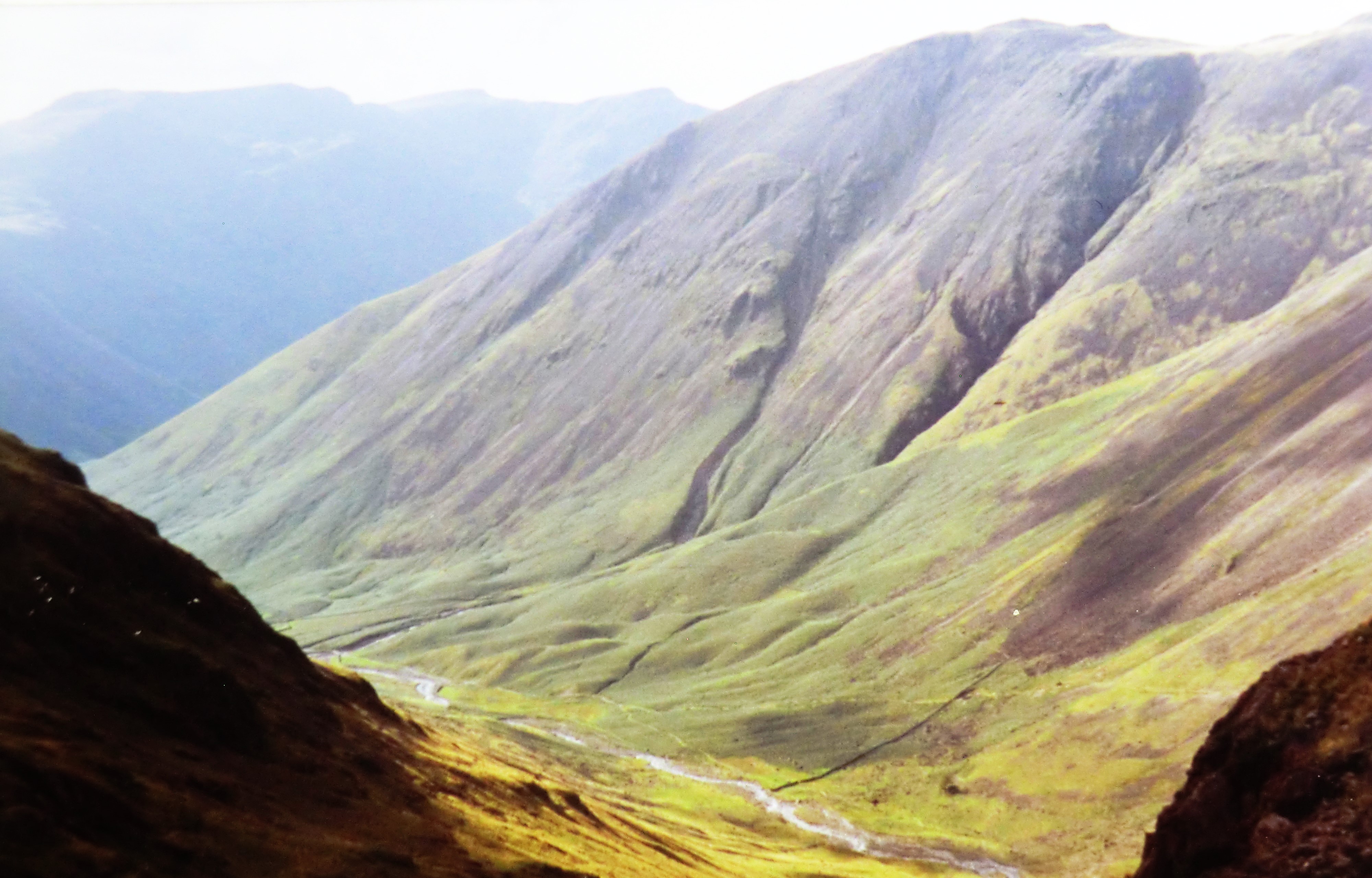
| Sty Head Tarn. |
 |
| We were at the cafe in Seathwaite hamlet. |
 |
| On our way up Scafell Pike. Great Gable is behind us. |
 |
| Standing on the Throne of England. |
 |
| From the summit, the clouds lifted. |
 |
| The lifting clouds created a dramatic scene. |
 |
| We both pose at the summit of Scafell Pike. |
 |
| A view across the Park from the summit. |
 |
| Lake Wastwater and the Irish Sea, from the summit. |
 |
| On our way down, Lake Wastwater. |
 |
| Great Gable. |
 |
| Sprinkling Tarn. |
 |
| Lake Elterwater with Langdale Pikes behind. |
 |
| We arrived back at Lake Grasmere. |
 |
| The only time we rowed! |
 |
| Windermere town. The two-week hike ends. |
---------------------------------------------------------------------------------------------------------------
Next Week: The 1993 trip to Israel gets underway.


Dear Frank, Richard and i had hoped to visit the Lake District during one of our trips to Blackpool to compete in the Open Ballroom Championship. Sadly, that excursion never materialized, but now I can experience it vicariously through your photos!
ReplyDeleteBlessings to you and Alex,
Laurie